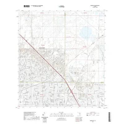
2021 Map of Murdock SE
USGS Topo · Published 2021About this map
North Port spans a significant portion of this southern Florida landscape, revealing a dense grid of residential planning and suburban development typical of the late 20th and early 21st centuries. The map showcases a complex system of managed water features, most notably the Cocoplum Waterway and Deep Creek, which navigate the low-lying terrain. The transition between Sarasota, Charlotte, and DeSoto counties is marked by a shift from the highly structured street networks of the south to the open, marshy lands and scattered agricultural tracts of the north, such as the B&R Ranch Rd area. In the northeast corner, the small settlement of Platt sits near the Peace River/State Trl, while the Lake Suzy Estates Airport serves as a distinct aviation landmark amidst the residential expansion. The presence of Restlawn Memorial Gardens provides a localized point of interest for researchers of recent local history and genealogy.
Find a feature on this map
325 named features on this map. Tap any name to fly to it.
Don’t see what you’re looking for? This feature index may not catch every label — zoom into the map to look around manually.
Map Details
Editions of this 2021 Murdock SE Map
This is the sole edition of this map. No revisions or reprints were ever made.
Other maps of this area

1956 · Murdock
USGS Topo · 1:24,000

1956 · Murdock SE
USGS Topo · 1:24,000

1956 · Murdock NE
USGS Topo · 1:24,000

1956 · Cleveland
USGS Topo · 1:24,000

1956 · Ft. Ogden
USGS Topo · 1:24,000

1956 · Nocatee
USGS Topo · 1:24,000

1956 · Murdock NW
USGS Topo · 1:24,000

1956 · West Palm Beach
USGS Topo · 1:250,000

1956 · Tampa
USGS Topo · 1:250,000

1956 · Fort Pierce
USGS Topo · 1:250,000
Featured Places
- North Port, FL
- Heritage Lake Park Community Development District, FL
- Lake Suzy, FL
- Sidell, North Port
- Deep Creek, FL