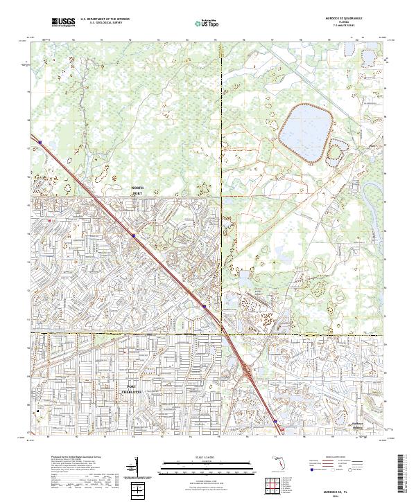
2024 Map of Murdock SE
USGS Topo · Published 2024About this map
North Port and Port Charlotte dominate this contemporary look at the residential expansion along the Sarasota and Charlotte county line. The landscape is defined by the extensive canal system of the Cocoplum Waterway and the winding course of the Peace River as it approaches the coast. This map documents the dense suburban grid of south Florida's Gulf Coast, where local infrastructure like the Lake Suzy Estates Airport and the Restlawn Memorial Gardens cemetery serve a growing population. Toward the north and east, the character shifts toward managed lands featuring the R V Griffin Reserve Trl, while the small settlement of Platt sits near the Desoto County border. The transition from the engineered waterways of the Port Charlotte neighborhoods to the natural drainage of Deep Creek illustrates the modern environmental management of this low-lying coastal region.
Find a feature on this map
20 named features on this map. Tap any name to fly to it.
Don’t see what you’re looking for? This feature index may not catch every label — zoom into the map to look around manually.
Map Details
Editions of this 2024 Murdock SE Map
This is the sole edition of this map. No revisions or reprints were ever made.
Other maps of this area

1956 · Murdock
USGS Topo · 1:24,000

1956 · Murdock SE
USGS Topo · 1:24,000

1956 · Murdock NE
USGS Topo · 1:24,000

1956 · Cleveland
USGS Topo · 1:24,000

1956 · Ft. Ogden
USGS Topo · 1:24,000

1956 · Nocatee
USGS Topo · 1:24,000

1956 · Murdock NW
USGS Topo · 1:24,000

1956 · West Palm Beach
USGS Topo · 1:250,000

1956 · Tampa
USGS Topo · 1:250,000

1956 · Fort Pierce
USGS Topo · 1:250,000
Featured Places
- North Port, FL
- Heritage Lake Park Community Development District, FL
- Platt, FL
- Lake Suzy, FL
- Sidell, North Port