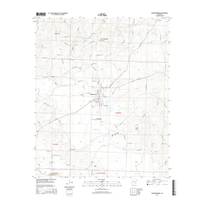
2014 Map of Murfreesboro
USGS Topo · Published 2014About this map
Murfreesboro serves as the central hub of this Pike County landscape, situated where the Little Missouri River bends south through a mix of bottomlands and rolling hills. The town is flanked by smaller settlements like Kimberley and Roy, reflecting a late-twentieth-century rural development pattern tied to established transportation routes like AR 27 Hwy N. To the west, Plaster Bluff overlooks the river valley, while the northern reaches include the crossroads of Mount Moriah and the industrial site of the Rock Quarry.
Find a feature on this map
117 named features on this map. Tap any name to fly to it.
Don’t see what you’re looking for? This feature index may not catch every label — zoom into the map to look around manually.
Map Details
Editions of this 2014 Murfreesboro Map
This is the sole edition of this map. No revisions or reprints were ever made.
Other maps of this area

1906 · Caddo Gap
USGS Topo · 1:125,000

1951 · Nashville
USGS Topo · 1:24,000

1951 · Pisgah
USGS Topo · 1:24,000

1951 · McCaskill
USGS Topo · 1:24,000

1953 · El Dorado
USGS Topo · 1:250,000

1955 · Little Rock
USGS Topo · 1:250,000

1956 · Little Rock
USGS Topo · 1:250,000

1957 · El Dorado
USGS Topo · 1:250,000

1958 · El Dorado
USGS Topo · 1:250,000

1960 · El Dorado
USGS Topo · 1:250,000