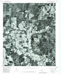
1980 Map of Murfreesboro
USGS Topo · Published 1982About this map
Murfreesboro sits at the heart of this Pike County orthophotoquad, where the winding course of the Little Missouri River meets the Muddy Fork. The 1980 aerial imagery reveals a landscape of dense timber punctuated by the clearings of agricultural fields and established settlements. To the south, the community of Kimberley and the hamlet of Roy mark the transition toward the area of Sweet Home. Unlike a standard topographic line drawing, this photo-based survey provides a direct look at land-use patterns and forest density during the early 1980s. The northern reaches are characterized by the highland settlement of Mt Moriah, situated above the river valley. This specific edition overlays land lines from a 1970 survey, offering a valuable reference for property boundaries and rural development near the river forks.
Find a feature on this map
7 named features on this map. Tap any name to fly to it.
Don’t see what you’re looking for? This feature index may not catch every label — zoom into the map to look around manually.
Map Details
Editions of this 1980 Murfreesboro Map
This is the sole edition of this map. No revisions or reprints were ever made.
Other maps of this area

1906 · Caddo Gap
USGS Topo · 1:125,000

1951 · Nashville
USGS Topo · 1:24,000

1951 · Pisgah
USGS Topo · 1:24,000

1951 · McCaskill
USGS Topo · 1:24,000

1953 · El Dorado
USGS Topo · 1:250,000

1955 · Little Rock
USGS Topo · 1:250,000

1956 · Little Rock
USGS Topo · 1:250,000

1957 · El Dorado
USGS Topo · 1:250,000

1958 · El Dorado
USGS Topo · 1:250,000

1960 · El Dorado
USGS Topo · 1:250,000