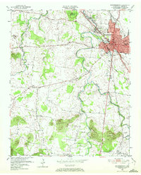
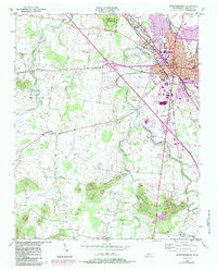
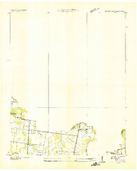
1950 Map of Murfreesboro
USGS Topo · Published 1972About this map
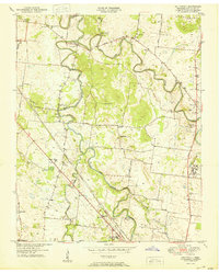
Stones River National Battlefield stands as a central historical landmark on this mid-century survey, preserving the grounds where Civil War encampments like Mil Park Gen Bragg Hdqrs and Mil Park Brannons Redoubt were once situated. The city of Murfreesboro is depicted during a period of significant local infrastructure, featuring the Central High Sch and Holloway High Sch, alongside the Nashville Chattanooga and St Louis RR which served the region's transport needs. To the south and west, the landscape transitions from the urban grid to the prominent elevations of the Barfield Knobs and Marshall Knobs. Smaller rural communities and post offices, such as Overall P O, Barfield, and Rucker, are connected by a network of historic pikes including Manson Pike and Eagleville Pike, illustrating the settlement patterns of Rutherford County before modern suburban expansion.
Find a feature on this map
57 named features on this map. Tap any name to fly to it.
Don’t see what you’re looking for? This feature index may not catch every label — zoom into the map to look around manually.
Map Details
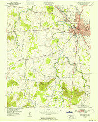
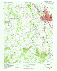
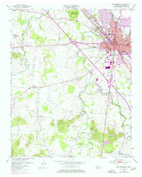
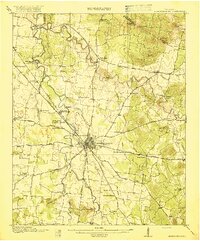
Editions of this 1950 Murfreesboro Map
5 editions found
Other maps of this area
1916 · Murfreesboro
USGS Topo · 1:62,500
1936 · Webbs Jungle
USGS Topo · 1:24,000
1936 · Rover
USGS Topo · 1:24,000
1936 · Fosterville
USGS Topo · 1:24,000

1942 · Lebanon
USGS Topo · 1:100,000

1944 · Shelbyville
USGS Topo · 1:100,000
1949 · Rover
USGS Topo · 1:24,000
1949 · Webbs Jungle
USGS Topo · 1:24,000
1949 · Fosterville
USGS Topo · 1:24,000
1950 · Walterhill
USGS Topo · 1:24,000
Featured Places
- Murfreesboro, TN
- Dixieland, TN
- Southern Aire, Murfreesboro
- Franklin Road Estates, Murfreesboro
- Ridgefield, Murfreesboro