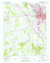
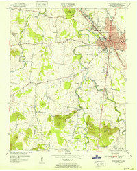
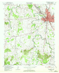
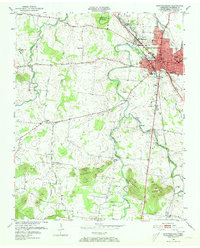
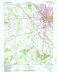
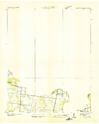
1950 Map of Murfreesboro
USGS Topo · Published 1977About this map
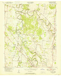
Stones River National Battlefield anchors the northwest corner of this map, preserving the site where the West Fork Stones River meanders through historic Civil War ground. The landscape transitions from the dense urban grid of Murfreesboro to the prominent elevations of the Barfield Knobs and Marshall Knobs. Within the city, the commercial and civic heart is visible near the Courthouse and Post Office, while the industrial and transit corridor follows the Louisville and Nashville railroad. Rural life in mid-century Rutherford County is recorded through numerous family burial grounds like Washington Cem and local schoolhouses including Halls Sch and Dillard Sch. The map reveals the early suburban expansion of Murfreesboro as it begins to encompass old settlements like Salem and the Overall P O, with developments stretching toward the Murfreesboro Country Club and the Fairgrounds.
Find a feature on this map
61 named features on this map. Tap any name to fly to it.
Don’t see what you’re looking for? This feature index may not catch every label — zoom into the map to look around manually.
Map Details
Editions of this 1950 Murfreesboro Map
5 editions found
Other maps of this area
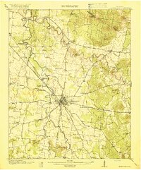
1916 · Murfreesboro
USGS Topo · 1:62,500
1936 · Webbs Jungle
USGS Topo · 1:24,000
1936 · Rover
USGS Topo · 1:24,000
1936 · Fosterville
USGS Topo · 1:24,000

1942 · Lebanon
USGS Topo · 1:100,000

1944 · Shelbyville
USGS Topo · 1:100,000
1949 · Rover
USGS Topo · 1:24,000
1949 · Webbs Jungle
USGS Topo · 1:24,000
1949 · Fosterville
USGS Topo · 1:24,000
1950 · Walterhill
USGS Topo · 1:24,000
Featured Places
- Murfreesboro, TN
- Dixieland, TN
- Southern Aire, Murfreesboro
- Franklin Road Estates, Murfreesboro
- Ridgefield, Murfreesboro