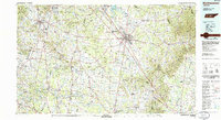
1985 Map of Murfreesboro
USGS Topo · Published 1986About this map
The Stones River National Battlefield and Cemetery serves as a centerpiece of this mid-1980s landscape, marking the historic Civil War site just northwest of the growing hub of Murfreesboro. The map illustrates a region in transition, where the expanding suburbs of Franklin and Brentwood meet the agricultural heart of Middle Tennessee. Significant landmarks like Middle Tennessee State University are well-established, while the Louisville & Nashville RR continues to define the transit corridors through Smyrna and down to Shelbyville.
Find a feature on this map
176 named features on this map. Tap any name to fly to it.
Don’t see what you’re looking for? This feature index may not catch every label — zoom into the map to look around manually.
Map Details
Editions of this 1985 Murfreesboro Map
This is the sole edition of this map. No revisions or reprints were ever made.
Other maps of this area

1893 · Mc Minnville
USGS Topo · 1:125,000

1895 · Mc Minnville
USGS Topo · 1:125,000

1895 · Sewanee
USGS Topo · 1:125,000

1901 · Colombia
USGS Topo · 1:125,000

1903 · Nashville
USGS Topo · 1:125,000

1908 · Woodbury
USGS Topo · 1:62,500

1909 · Franklin
USGS Topo · 1:62,500

1913 · Hollow Springs
USGS Topo · 1:62,500

1916 · Murfreesboro
USGS Topo · 1:62,500

1928 · Gordonsville
USGS Topo · 1:62,500