2023 Map of Murphy
USGS Topo · Published 2023About this map
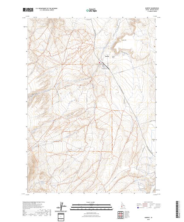
Murphy serves as the focal point of this high-desert Owyhee County landscape, centered around the Murphy Courthouse and the nearby Murphy Airport. This map illustrates a transition from the structured civic center of the county seat to the expansive terrain of the Murphy Rim and Striker Basin. Water management is evident through the presence of the Murphy Mutual Canal and several seasonal water sources like Rabbit Creek and Scorpion Creek. The local infrastructure follows a pattern of historic and modern transit, with the Old Stage Rd cutting through the center and newer routes like Silver City Rd and Murphy Grandview Rd connecting the settlement to the surrounding flats. Landforms such as Flatiron Ridge and Striker Basin Gulch define the topography, while isolated water sources like Point of Rocks Spring and Success Spring provide essential landmarks in the arid environment south of the Snake River canyon.
Find a feature on this map
74 named features on this map. Tap any name to fly to it.
Don’t see what you’re looking for? This feature index may not catch every label — zoom into the map to look around manually.
Map Details
Editions of this 2023 Murphy Map
This is the sole edition of this map. No revisions or reprints were ever made.