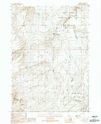
1990 Map of Murphy
USGS Topo · Published 1991About this map
Murphy serves as the focal point for this high-desert landscape in southwestern Idaho, situated just south of the Snake River. The settlement is clearly defined by its essential infrastructure, including a Landing Strip, Airport, and local Rodeo Ground. This region is dominated by the Birds of Prey Area, where the terrain rises from the river canyon toward prominent landmarks like Federal Butte and the distinct Flatiron Ridge.
Find a feature on this map
35 named features on this map. Tap any name to fly to it.
Don’t see what you’re looking for? This feature index may not catch every label — zoom into the map to look around manually.
Map Details
Editions of this 1990 Murphy Map
This is the sole edition of this map. No revisions or reprints were ever made.
Other maps of this area

1892 · Bisuka
USGS Topo · 1:125,000

1892 · Silver City
USGS Topo · 1:125,000

1894 · Bisuka
USGS Topo · 1:125,000

1894 · Silver City
USGS Topo · 1:125,000

1898 · Silver City
USGS Topo · 1:125,000

1948 · Sinker Butte
USGS Topo · 1:24,000

1949 · Sinker Butte
USGS Topo · 1:24,000

1949 · Oreana
USGS Topo · 1:62,500
1949 · Oreana
USGS Topo · 1:24,000
1950 · Oreana
USGS Topo · 1:24,000