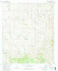
1981 Map of Murphy Peak
USGS Topo · Published 1981About this map
Coronado National Forest defines the eastern and central portion of this 1981 survey, where the Tumacacori Mountains rise sharply above the Arizona high desert. The landscape is a network of arid drainage systems, including Moyza Canyon, Cedar Canyon, and the East Fork of the Murphy drainage. Human presence in this high-relief terrain is documented through a series of water management features essential for ranching and survival, ranging from Papalote Tank in the northwest to Arivaca Lake in the southwest.
Find a feature on this map
62 named features on this map. Tap any name to fly to it.
Don’t see what you’re looking for? This feature index may not catch every label — zoom into the map to look around manually.
Map Details
Editions of this 1981 Murphy Peak Map
2 editions found
Other maps of this area

1920 · Arivaca
USGS Topo · 1:125,000

1921 · Old Glory
USGS Topo · 1:125,000

1939 · Tubac
USGS Topo · 1:62,500

1941 · Arivaca
USGS Topo · 1:62,500

1942 · Ruby
USGS Topo · 1:62,500

1942 · Oro Blanco
USGS Topo · 1:62,500

1943 · Arivaca
USGS Topo · 1:62,500

1943 · Old Glory
USGS Topo · 1:125,000

1943 · Tubac
USGS Topo · 1:62,500

1944 · Oro Blanco
USGS Topo · 1:62,500