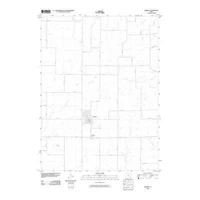
2010 Map of Murray
USGS Topo · Published 2010About this map
Murray serves as the central hub of this Clarke County landscape, situated where the grid of rural township roads meets the East-West corridor of Route 34. This 2010 survey illustrates a quintessential Iowan agricultural pattern, where the land is deeply etched by a network of drainage ways including South River, White Breast Creek, and East Long Creek. The settlement of Murray is well-defined, containing the Murray Post Office and providing a clear look at the town's residential street layout before it transitions into the expansive sections of the surrounding countryside.
Find a feature on this map
35 named features on this map. Tap any name to fly to it.
Don’t see what you’re looking for? This feature index may not catch every label — zoom into the map to look around manually.
Map Details
Editions of this 2010 Murray Map
This is the sole edition of this map. No revisions or reprints were ever made.
Other maps of this area

1951 · Osceola
USGS Topo · 1:62,500

1951 · Afton
USGS Topo · 1:62,500

1954 · Centerville
USGS Topo · 1:250,000

1954 · Omaha
USGS Topo · 1:250,000

1954 · Des Moines
USGS Topo · 1:250,000

1955 · Nebraska City
USGS Topo · 1:250,000

1956 · Des Moines
USGS Topo · 1:250,000

1957 · Des Moines
USGS Topo · 1:250,000

1957 · Nebraska City
USGS Topo · 1:250,000

1957 · Omaha
USGS Topo · 1:250,000