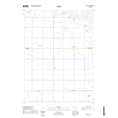
2017 Map of Murray Lake
USGS Topo · Published 2017About this map
Pleasant Hill Cem marks the local heritage of this rural landscape along the border of Scotts Bluff and Banner counties. The terrain is defined by a series of dramatic erosional features, including Shoemaker Canyon, Whipple Canyon, and the prominent Cottonwood Canyon to the east. These landforms create a distinct breaks-style topography that contrasts with the flatter agricultural sections of the Nebraska panhandle.
Find a feature on this map
32 named features on this map. Tap any name to fly to it.
Don’t see what you’re looking for? This feature index may not catch every label — zoom into the map to look around manually.
Map Details
Editions of this 2017 Murray Lake Map
This is the sole edition of this map. No revisions or reprints were ever made.
Other maps of this area

1898 · Scotts Bluff
USGS Topo · 1:125,000

1899 · Goshen Hole
USGS Topo · 1:125,000

1954 · Scottsbluff
USGS Topo · 1:250,000

1954 · Cheyenne
USGS Topo · 1:250,000

1958 · Cheyenne
USGS Topo · 1:250,000

1958 · Scottsbluff
USGS Topo · 1:250,000

1960 · Tremain
USGS Topo · 1:24,000

1960 · Mc Compsey Pass
USGS Topo · 1:24,000

1960 · Stegall
USGS Topo · 1:24,000

1960 · Murray Lake
USGS Topo · 1:24,000