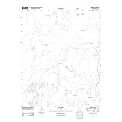
2011 Map of Murray
USGS Topo · Published 2011About this map
The Little Buffalo River and its East Fork carve a complex system of ridges and hollows through this portion of Newton County. The small settlements of Shiloh, Murray, and Wayton are the primary points of habitation, connected by winding mountain roads like Murray Rd and Daniels Ridge Rd. The landscape is defined by its dramatic elevation changes, featuring landmarks such as Shiloh Mountain, Taylor Mountain, and the prominent Rainbow Bluff. Genealogists will find several burial sites recorded, including Shiloh Cemetery, Snow Cemetery, and Rich Cemetery, which serve as markers of the families who settled these upland coves. The names of the terrain, from Douthard Hollow to Haunt Hollow, reflect the local nomenclature of the Ozark interior. The map also documents numerous forestry or service roads, identified by numeric codes, providing a detailed record of the access network used for land management at this time.
Find a feature on this map
102 named features on this map. Tap any name to fly to it.
Don’t see what you’re looking for? This feature index may not catch every label — zoom into the map to look around manually.
Map Details
Editions of this 2011 Murray Map
This is the sole edition of this map. No revisions or reprints were ever made.
Other maps of this area

1904 · Harrison
USGS Topo · 1:125,000

1905 · Harrison
USGS Topo · 1:125,000

1933 · Mt Judea
USGS Topo · 1:62,500

1940 · Mt Judea
USGS Topo · 1:62,500

1945 · Harrison
USGS Topo · 1:250,000

1949 · Harrison
USGS Topo · 1:250,000

1954 · Harrison
USGS Topo · 1:250,000

1956 · Russellville
USGS Topo · 1:250,000

1958 · Harrison
USGS Topo · 1:250,000

1964 · Russellville
USGS Topo · 1:250,000