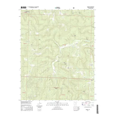
2017 Map of Murray
USGS Topo · Published 2017About this map
The Little Buffalo River carves a deep path through the northern reaches of the Ozark National Forest, where the remote settlement of Murray stands at a convergence of mountain hollows. This high country of Newton County is defined by prominent elevations such as Shiloh Mtn and Henderson Mtn, with the northern edge of the map dipping into the Buffalo National River corridor. Genealogy and local history are anchored by several established burial grounds, including Shiloh Cem and Snow Cem, which reflect the community's dispersed rural roots. Narrow roads like Walker Mtn Rd and Newton 8625 Rd navigate the steep grades of Rainbow Bluff and Long Point, tracing a landscape where timber and terrain have long shaped human movement and settlement.
Find a feature on this map
75 named features on this map. Tap any name to fly to it.
Don’t see what you’re looking for? This feature index may not catch every label — zoom into the map to look around manually.
Map Details
Editions of this 2017 Murray Map
This is the sole edition of this map. No revisions or reprints were ever made.
Other maps of this area

1904 · Harrison
USGS Topo · 1:125,000

1905 · Harrison
USGS Topo · 1:125,000

1933 · Mt Judea
USGS Topo · 1:62,500

1940 · Mt Judea
USGS Topo · 1:62,500

1945 · Harrison
USGS Topo · 1:250,000

1949 · Harrison
USGS Topo · 1:250,000

1954 · Harrison
USGS Topo · 1:250,000

1956 · Russellville
USGS Topo · 1:250,000

1958 · Harrison
USGS Topo · 1:250,000

1964 · Russellville
USGS Topo · 1:250,000