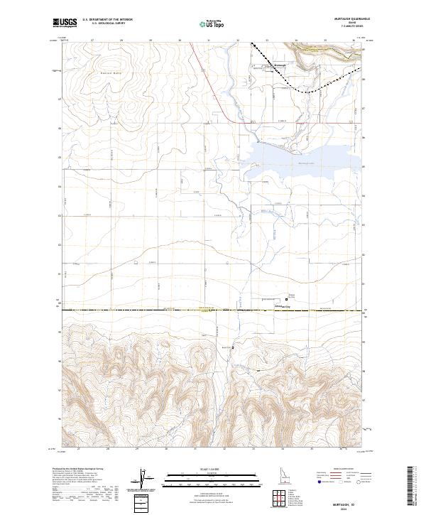
2024 Map of Murtaugh
USGS Topo · Published 2024About this map
Murtaugh and Artesian City anchor a landscape defined by the intricate water management systems of the Snake River Plain. The northern reaches of the map show the Snake River winding near the border of Jerome and Twin Falls counties, feeding into the massive agricultural infrastructure of the Twin Falls Main Canal and Milner Main Canal. These waterways transform the high desert into a productive grid of farm roads and fields, punctuated by local landmarks like Hansen Butte and the broad waters of Murtaugh Lake. Further south, the terrain transitions into the more varied topography surrounding Cold Spring Creek and the foothills below the southern county line. For those researching local history, the map provides precise locations for the Artesian City Cem and Bower Cem, offering essential grounding for genealogical study within this rural Idaho community.
Find a feature on this map
30 named features on this map. Tap any name to fly to it.
Don’t see what you’re looking for? This feature index may not catch every label — zoom into the map to look around manually.
Map Details
Editions of this 2024 Murtaugh Map
This is the sole edition of this map. No revisions or reprints were ever made.
Other maps of this area

1955 · Twin Falls
USGS Topo · 1:250,000

1958 · Twin Falls
USGS Topo · 1:250,000

1964 · Kimberly
USGS Topo · 1:24,000

1964 · Eden
USGS Topo · 1:24,000

1964 · Milner
USGS Topo · 1:24,000

1965 · Rams Horn Ridge
USGS Topo · 1:24,000

1965 · Milner Butte
USGS Topo · 1:24,000

1965 · Stricker Butte
USGS Topo · 1:24,000

1965 · Grand View Peak
USGS Topo · 1:24,000

1965 · Murtaugh
USGS Topo · 1:24,000