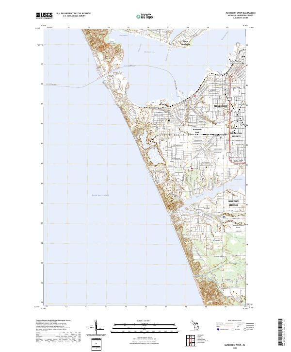
2023 Map of Muskegon West
USGS Topo · Published 2023About this map
Muskegon Lake and the Muskegon River dominate the landscape of this Lake Michigan shoreline, where the city of Muskegon sits at a geographic crossroads. The transition from industrial waterfront to residential districts is visible through features like Ruddiman Lagoon and Pigeon Hill. The map provides significant genealogical value, identifying several specific memorial sites including the Old Indian Cem near the river's mouth, the Saint Paul's Episcopal Church Columbarium, and Marys Cem. Transportation remains central to the area's identity, from the Lake Express Ferry terminal on the lakefront to the Muskegon County Airport further inland near Norton Shores. The residential growth of Roosevelt Park and Muskegon Heights is mapped in detail, showing a densely settled corridor bordered by Mona Lake and Black Creek.
Find a feature on this map
112 named features on this map. Tap any name to fly to it.
Don’t see what you’re looking for? This feature index may not catch every label — zoom into the map to look around manually.
Map Details
Editions of this 2023 Muskegon West Map
This is the sole edition of this map. No revisions or reprints were ever made.
Other maps of this area

1929 · Montague
USGS Topo · 1:48,000

1930 · Lake Harbor
USGS Topo · 1:48,000

1930 · Muskegon
USGS Topo · 1:62,500

1936 · Muskegon
USGS Topo · 1:62,500

1936 · Lake Harbor
USGS Topo · 1:62,500

1954 · Milwaukee
USGS Topo · 1:250,000

1958 · Milwaukee
USGS Topo · 1:250,000

1958 · Twin Lake
USGS Topo · 1:62,500

1959 · Montague
USGS Topo · 1:62,500
1972 · Muskegon West
USGS Topo · 1:24,000