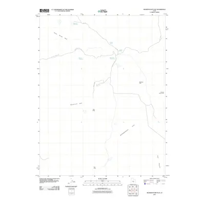
2011 Map of Mussentuchit Flat
USGS Topo · Published 2011About this map
Mussentuchit Flat defines the high desert landscape of Emery County in this 2011 survey, where the drainages of Mussentuchit Wash and Willow Springs Wash dictate the movement of water and travel. The area is marked by significant topographical landmarks such as Deadman Peak, Twin Peaks, and the rising slopes of Herbes Mountain and Cedar Mountain. Human presence in this arid environment is centered on water management, evidenced by several strategically placed catchments including Blue Flat Reservoir, Wests Reservoir, and Road End Reservoir.
Find a feature on this map
20 named features on this map. Tap any name to fly to it.
Don’t see what you’re looking for? This feature index may not catch every label — zoom into the map to look around manually.
Map Details
Editions of this 2011 Mussentuchit Flat Map
This is the sole edition of this map. No revisions or reprints were ever made.
Other maps of this area

1885 · Fish Lake
USGS Topo · 1:250,000

1896 · Fish Lake
USGS Topo · 1:250,000

1925 · Acord Lakes
USGS Topo · 1:62,500

1953 · Emery 4 NE
USGS Topo · 1:24,000

1953 · Emery 4 SE
USGS Topo · 1:24,000

1953 · Emery 1 SE
USGS Topo · 1:24,000

1956 · Salina
USGS Topo · 1:250,000

1960 · Salina
USGS Topo · 1:250,000

1962 · Salina
USGS Topo · 1:250,000
1968 · Solomons Temple
USGS Topo · 1:24,000