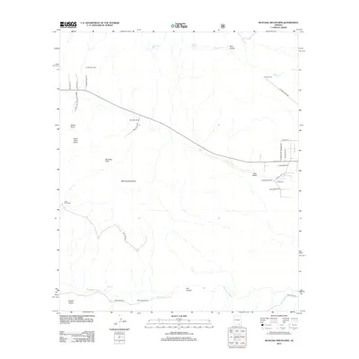
2012 Map of Mustang Mountains
USGS Topo · Published 2012About this map
Mustang Mountains dominate the central landscape of this Cochise County region, rising toward Mustang Peak and Mount Bruce. The map documents a ranching-heavy corridor where the high desert meets rugged canyon topography, notably around Lyle Canyon and Vaughn Canyon. Settlement patterns are defined by established family and working holdings such as Sands Ranch, Rain Valley Ranch, and Babocomari Ranch, all situated near vital water sources like the Babocomari River and T 4 Springs. In the north, Mescal Cr and Mine Canyon cut through the terrain, while the residential development of Rain Valley shows a more modern grid of local roads like W Puesta Del Sol and W El Rancho Blvd branching off the main thoroughfares.
Find a feature on this map
37 named features on this map. Tap any name to fly to it.
Don’t see what you’re looking for? This feature index may not catch every label — zoom into the map to look around manually.
Map Details
Editions of this 2012 Mustang Mountains Map
This is the sole edition of this map. No revisions or reprints were ever made.
Other maps of this area

1904 · Patagonia
USGS Topo · 1:125,000

1905 · Patagonia
USGS Topo · 1:125,000

1915 · Benson
USGS Topo · 1:125,000

1926 · Whetstone
USGS Topo · 1:62,500

1932 · Elgin
USGS Topo · 1:62,500

1938 · Huachuca
USGS Topo · 1:62,500

1940 · Elgin
USGS Topo · 1:62,500

1943 · Benson
USGS Topo · 1:125,000

1947 · Elgin
USGS Topo · 1:62,500

1948 · Elgin
USGS Topo · 1:24,000