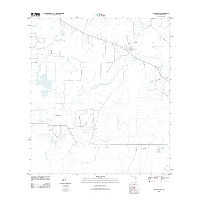
2012 Map of Myakka City
USGS Topo · Published 2012About this map
Myakka River winds through this rural section of Manatee County, defining a landscape shaped by slow-moving water and agricultural development. The terrain is characterized by numerous seasonal waterways and drainage features like Tatum Gully and Clay Gully, which cut through the flat topography typical of south-central Florida. Cultural and community landmarks are sparse but significant, notably the Sardis Cem, providing a focal point for genealogical research in this sparsely populated area. The presence of Dankin Dairy in the eastern portion of the map highlights the enduring importance of large-scale agriculture and ranching. The road network, including names like Wauchula Rd and A D Taylor Rd, reflects the historical property lines and the movement of goods and livestock toward regional markets.
Find a feature on this map
44 named features on this map. Tap any name to fly to it.
Don’t see what you’re looking for? This feature index may not catch every label — zoom into the map to look around manually.
Map Details
Editions of this 2012 Myakka City Map
This is the sole edition of this map. No revisions or reprints were ever made.
Other maps of this area

1944 · Lower Myakka Lake
USGS Topo · 1:31,680

1944 · Verna
USGS Topo · 1:31,680

1944 · Miakka
USGS Topo · 1:31,680

1956 · Myakka City
USGS Topo · 1:24,000

1956 · Edgeville
USGS Topo · 1:24,000

1956 · Myakka City NW
USGS Topo · 1:24,000

1956 · Murdock NE
USGS Topo · 1:24,000

1956 · Myakka Head
USGS Topo · 1:24,000

1956 · Murdock NW
USGS Topo · 1:24,000

1956 · Tampa
USGS Topo · 1:250,000