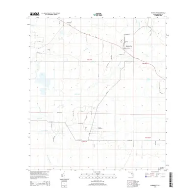
2015 Map of Myakka City
USGS Topo · Published 2015About this map
Myakka City serves as the central hub of this Florida landscape, situated where SR-70 E intersects with local routes like Wauchula Rd and Bradenton Arcadia Rd. The community is defined by its relationship to the Myakka River, which winds through the central and western portions of the quadrangle. North of the city, the settlement of Parmalee sits along the same highway corridor, while the southern reaches are marked by the Sardis Cem near Clay Gully Rd.
Find a feature on this map
55 named features on this map. Tap any name to fly to it.
Don’t see what you’re looking for? This feature index may not catch every label — zoom into the map to look around manually.
Map Details
Editions of this 2015 Myakka City Map
This is the sole edition of this map. No revisions or reprints were ever made.
Other maps of this area

1944 · Lower Myakka Lake
USGS Topo · 1:31,680

1944 · Verna
USGS Topo · 1:31,680

1944 · Miakka
USGS Topo · 1:31,680

1956 · Myakka City
USGS Topo · 1:24,000

1956 · Edgeville
USGS Topo · 1:24,000

1956 · Myakka City NW
USGS Topo · 1:24,000

1956 · Murdock NE
USGS Topo · 1:24,000

1956 · Myakka Head
USGS Topo · 1:24,000

1956 · Murdock NW
USGS Topo · 1:24,000

1956 · Tampa
USGS Topo · 1:250,000