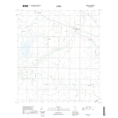
2018 Map of Myakka City
USGS Topo · Published 2018About this map
The Myakka River winds through this section of Manatee County, defining a landscape dominated by extensive wetlands and water management systems. The small settlement of Myakka City serves as the primary hub, situated near the junction of Wauchula Rd and State Road 70. To the northwest, Parmalee marks another point of settlement in an area otherwise characterized by agricultural and dairy operations, such as Dankin Dairy.
Find a feature on this map
52 named features on this map. Tap any name to fly to it.
Don’t see what you’re looking for? This feature index may not catch every label — zoom into the map to look around manually.
Map Details
Editions of this 2018 Myakka City Map
This is the sole edition of this map. No revisions or reprints were ever made.
Other maps of this area

1944 · Lower Myakka Lake
USGS Topo · 1:31,680

1944 · Verna
USGS Topo · 1:31,680

1944 · Miakka
USGS Topo · 1:31,680

1956 · Myakka City
USGS Topo · 1:24,000

1956 · Edgeville
USGS Topo · 1:24,000

1956 · Myakka City NW
USGS Topo · 1:24,000

1956 · Murdock NE
USGS Topo · 1:24,000

1956 · Myakka Head
USGS Topo · 1:24,000

1956 · Murdock NW
USGS Topo · 1:24,000

1956 · Tampa
USGS Topo · 1:250,000