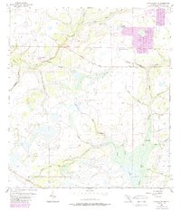
1956 Map of Myakka City NW
USGS Topo · Published 1987About this map
Kibler Ranch and its adjacent Kibler Lookout Tower anchor the northwestern portion of this landscape, which is defined by a dense network of watercourses and seasonal wetlands in Manatee County. The drainage patterns are complex, with the Myakka River flowing through the eastern reaches, while the North Fork East Fork Manatee River and Little Fort Crawford Creek drain the west. Significant open areas like Coker Prairie and Johnson Prairie suggest a landscape largely dedicated to cattle ranching and timber during the mid-20th century.
Find a feature on this map
22 named features on this map. Tap any name to fly to it.
Don’t see what you’re looking for? This feature index may not catch every label — zoom into the map to look around manually.
Map Details
Editions of this 1956 Myakka City NW Map
3 editions found
Other maps of this area

1944 · Rye
USGS Topo · 1:31,680

1944 · Verna
USGS Topo · 1:31,680

1944 · Miakka
USGS Topo · 1:31,680

1956 · Myakka City
USGS Topo · 1:24,000

1956 · Edgeville
USGS Topo · 1:24,000

1956 · Myakka City NW
USGS Topo · 1:24,000

1956 · Myakka Head
USGS Topo · 1:24,000

1956 · Duette
USGS Topo · 1:24,000

1956 · Keentown
USGS Topo · 1:24,000

1956 · Tampa
USGS Topo · 1:250,000