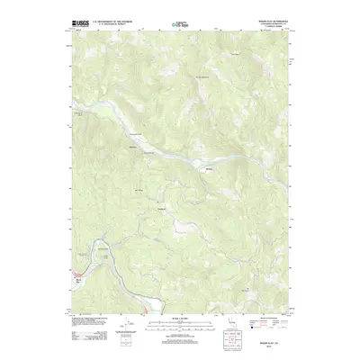
2012 Map of Myers Flat
USGS Topo · Published 2012About this map
Myers Flat and the surrounding Humboldt County wilderness are defined by the winding course of the Eel River and its South Fork Eel River. This 2012 landscape illustrates a complex network of ridgeline roads and river-valley settlements, where the topography dictates human movement. Notable points of interest include the small communities of McCann, Fruitland, and Whitlow, each positioned near the water or along the high Mail Ridge. The map documents a rugged interior featuring Eagle Point, Thompson Bluff, and The Peaks, while also highlighting recreational sites like Hidden Springs Campground. A web of service and logging routes, such as Dyerville Loop Rd and McCann Rd, connects these isolated locations, tracing the sharp elevation changes between the riverbanks and heights like Brushy Mountain and Elk Mountain.
Find a feature on this map
47 named features on this map. Tap any name to fly to it.
Don’t see what you’re looking for? This feature index may not catch every label — zoom into the map to look around manually.
Map Details
Editions of this 2012 Myers Flat Map
This is the sole edition of this map. No revisions or reprints were ever made.
Other maps of this area

1920 · Harris
USGS Topo · 1:62,500

1921 · Dyerville
USGS Topo · 1:62,500

1921 · Briceland
USGS Topo · 1:62,500

1949 · Blocksburg
USGS Topo · 1:62,500

1949 · Alderpoint
USGS Topo · 1:62,500

1949 · Garberville
USGS Topo · 1:62,500

1949 · Weott
USGS Topo · 1:62,500

1951 · Alderpoint
USGS Topo · 1:62,500

1951 · Weott
USGS Topo · 1:62,500

1951 · Garberville
USGS Topo · 1:62,500