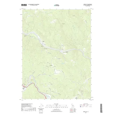
2018 Map of Myers Flat
USGS Topo · Published 2018About this map
Myers Flat and the surrounding Humboldt County wilderness are defined by the convergence of the Eel River and the South Fork Eel River. This 2018 survey documents the small settlements of Fruitland, McCann, and Whitlow, which are tucked along the riverbanks and hillsides of the North Coast. The landscape is marked by high elevation points such as Brushy Mtn, The Peaks, and Eagle Point, illustrating the extreme verticality of the redwood country. Local history is preserved in landmarks like South Fork Cem and old transportation routes including Dyerville Loop Rd and Mail Ridge. The network of private ranches and fire roads, such as Cathy Ranch Rd and Wheeler Ranch Rd, highlights the contemporary land use patterns where family-named properties continue to define the geography of the Eel River valley.
Find a feature on this map
59 named features on this map. Tap any name to fly to it.
Don’t see what you’re looking for? This feature index may not catch every label — zoom into the map to look around manually.
Map Details
Editions of this 2018 Myers Flat Map
This is the sole edition of this map. No revisions or reprints were ever made.
Other maps of this area

1920 · Harris
USGS Topo · 1:62,500

1921 · Dyerville
USGS Topo · 1:62,500

1921 · Briceland
USGS Topo · 1:62,500

1949 · Blocksburg
USGS Topo · 1:62,500

1949 · Alderpoint
USGS Topo · 1:62,500

1949 · Garberville
USGS Topo · 1:62,500

1949 · Weott
USGS Topo · 1:62,500

1951 · Alderpoint
USGS Topo · 1:62,500

1951 · Weott
USGS Topo · 1:62,500

1951 · Garberville
USGS Topo · 1:62,500