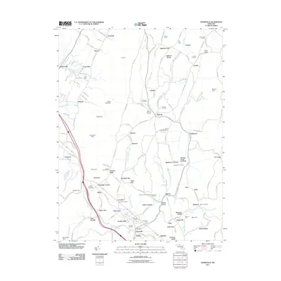
2011 Map of Myersville
USGS Topo · Published 2011About this map
Myersville and the surrounding Frederick County countryside are defined by a complex network of family farms and mountain landmarks in this detailed landscape. The terrain rises sharply to the west toward South Mountain, where prominent features like Annapolis Rock, Black Rock, and Monument Knob line the ridge. This area serves as a focal point for local history and recreation, anchored by Camp Mount Aetna. The map reveals a dense distribution of rural burial grounds, including the Summers Family Cemetery, Grossnickles Cemetery, and Wolfsville Reformed Cemetery, which underscore the deep-rooted genealogical heritage of the valley. Settlement patterns follow the winding paths of Little Catoctin Creek and Middle Creek, connecting small communities and named homesteads such as Wistmans Delight, Flook Farm, and Thunderhill Farms. The orientation of these clusters suggests a long history of agricultural tenure and localized community life along the eastern slopes of the mountain range.
Find a feature on this map
160 named features on this map. Tap any name to fly to it.
Don’t see what you’re looking for? This feature index may not catch every label — zoom into the map to look around manually.
Map Details
Editions of this 2011 Myersville Map
This is the sole edition of this map. No revisions or reprints were ever made.
Other maps of this area

1884 · Harpers Ferry
USGS Topo · 1:125,000

1891 · Harpers Ferry
USGS Topo · 1:125,000

1893 · Frederick
USGS Topo · 1:125,000

1893 · Harpers Ferry
USGS Topo · 1:125,000

1894 · Frederick
USGS Topo · 1:125,000

1908 · Middletown
USGS Topo · 1:48,000

1908 · Ijamsville
USGS Topo · 1:62,500

1909 · Ijamsville
USGS Topo · 1:62,500

1909 · Hagerstown
USGS Topo · 1:48,000

1910 · Antietam
USGS Topo · 1:62,500