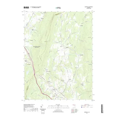
2019 Map of Myersville
USGS Topo · Published 2019About this map
South Mountain and Catoctin Mtn frame this corridor of rural Frederick County, where small agricultural settlements and family burial grounds are connected by the historic National Pike. The town of Myersville sits at the southern edge, while the surrounding valley is dotted with hamlets like Wolfsville, Ellerton, and Jerusalem. This 2019 survey documents a landscape where modern recreation on the Appalachian National Scenic Trail intersects with deep-rooted local history, evidenced by numerous private and congregational burial sites such as Grossnickles Cem and the Summers Family Cem. The terrain is defined by watercourses like Little Catoctin Cr and Middle Cr flowing through prominent gaps like Black Rock Gap. On the western ridge, Monument Knob overlooks the valley, marking a significant point of elevation along the county boundary.
Find a feature on this map
126 named features on this map. Tap any name to fly to it.
Don’t see what you’re looking for? This feature index may not catch every label — zoom into the map to look around manually.
Map Details
Editions of this 2019 Myersville Map
This is the sole edition of this map. No revisions or reprints were ever made.
Other maps of this area

1884 · Harpers Ferry
USGS Topo · 1:125,000

1891 · Harpers Ferry
USGS Topo · 1:125,000

1893 · Frederick
USGS Topo · 1:125,000

1893 · Harpers Ferry
USGS Topo · 1:125,000

1894 · Frederick
USGS Topo · 1:125,000

1908 · Middletown
USGS Topo · 1:48,000

1908 · Ijamsville
USGS Topo · 1:62,500

1909 · Ijamsville
USGS Topo · 1:62,500

1909 · Hagerstown
USGS Topo · 1:48,000

1910 · Antietam
USGS Topo · 1:62,500