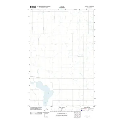
2011 Map of Mylo NW
USGS Topo · Published 2011About this map
Long Lake dominates the southwestern corner of this prairie landscape in Rolette County, marking the most significant natural landmark in a region otherwise defined by the rigid geometry of the Public Land Survey System. The area is gridded by an extensive network of rural corridors, including east-west thoroughfares such as 86th St NE and 92nd St NE, which intersect with north-south routes like 43rd Ave NE and 49th Ave NE. These roads delineate the section lines typical of the North Dakota plains, illustrating the agricultural layout and land management patterns of the early 21st century. The map reflects a sparsely populated rural district where the terrain is dotted with small prairie potholes and wetlands characteristic of the Northern Great Plains drainage.
Find a feature on this map
17 named features on this map. Tap any name to fly to it.
Don’t see what you’re looking for? This feature index may not catch every label — zoom into the map to look around manually.
Map Details
Editions of this 2011 Mylo NW Map
This is the sole edition of this map. No revisions or reprints were ever made.
Other maps of this area

1936 · Lake Upsilon
USGS Topo · 1:48,000

1942 · Lake Upsilon
USGS Topo · 1:62,500

1953 · Devils Lake
USGS Topo · 1:250,000

1956 · Devils Lake
USGS Topo · 1:250,000

1968 · Lake Upsilon SE
USGS Topo · 1:24,000

1968 · Belcourt
USGS Topo · 1:24,000

1970 · Rolla
USGS Topo · 1:24,000

1971 · Island Lake
USGS Topo · 1:24,000

1971 · Mylo
USGS Topo · 1:24,000

1971 · Mylo NW
USGS Topo · 1:24,000