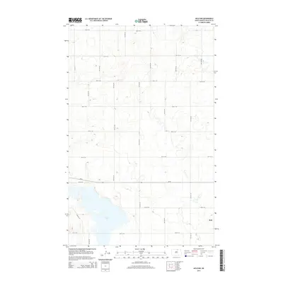
2014 Map of Mylo NW
USGS Topo · Published 2014About this map
Mylo sits at the southeastern corner of this North Dakota landscape, situated at the intersection of a grid-based rural road network. The terrain is defined by the expansive Long Lake, which stretches across the southern section of the quadrangle, and numerous smaller unnamed wetlands and depressions characteristic of the prairie pothole region. Transport through Rolette County is primarily facilitated by Nd-66, which runs east-west across the lower third of the map. The survey reveals a highly organized township and range system, with numbered avenues like 45th Ave NE and streets like 90th St NE forming a precise lattice over the agricultural land. This 2014 edition, produced by the U.S. Geological Survey, uses high-resolution imagery to document the shoreline of Long Lake and the rural development surrounding the small settlement of Mylo.
Find a feature on this map
21 named features on this map. Tap any name to fly to it.
Don’t see what you’re looking for? This feature index may not catch every label — zoom into the map to look around manually.
Map Details
Editions of this 2014 Mylo NW Map
This is the sole edition of this map. No revisions or reprints were ever made.
Other maps of this area

1936 · Lake Upsilon
USGS Topo · 1:48,000

1942 · Lake Upsilon
USGS Topo · 1:62,500

1953 · Devils Lake
USGS Topo · 1:250,000

1956 · Devils Lake
USGS Topo · 1:250,000

1968 · Lake Upsilon SE
USGS Topo · 1:24,000

1968 · Belcourt
USGS Topo · 1:24,000

1970 · Rolla
USGS Topo · 1:24,000

1971 · Island Lake
USGS Topo · 1:24,000

1971 · Mylo
USGS Topo · 1:24,000

1971 · Mylo NW
USGS Topo · 1:24,000