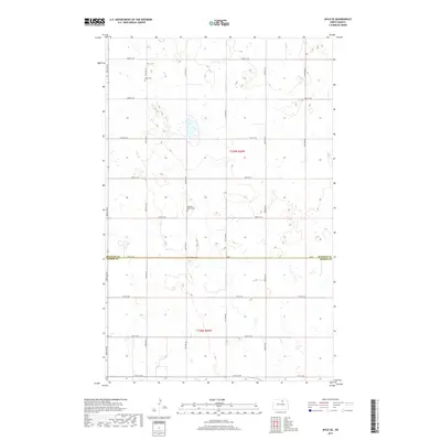
2017 Map of Mylo SE
USGS Topo · Published 2017About this map
The rolling prairie of the North Dakota plains is meticulously documented in this 2017 survey, where the boundary between Rolette Co and Pierce Co divides a landscape of small glacial wetlands and agricultural sections. The map provides essential detail for family historians, particularly through the inclusion of Mylo Cem in the north and Pleasant Valley Cem further south. The region's organized development is clearly visible through a strict grid of section lines and gravel roads, including north-south corridors like 48th Ave NE and 51st Ave NE, which intersect with east-west routes like 80th St NE. This layout reflects the enduring impact of the Public Land Survey System on the geography of t159n r69w and t158n r69w.
Find a feature on this map
20 named features on this map. Tap any name to fly to it.
Don’t see what you’re looking for? This feature index may not catch every label — zoom into the map to look around manually.
Map Details
Editions of this 2017 Mylo SE Map
This is the sole edition of this map. No revisions or reprints were ever made.
Other maps of this area

1953 · Devils Lake
USGS Topo · 1:250,000

1956 · Devils Lake
USGS Topo · 1:250,000

1971 · Wolford
USGS Topo · 1:24,000

1971 · Bisbee South
USGS Topo · 1:24,000

1971 · Island Lake
USGS Topo · 1:24,000

1971 · Mylo
USGS Topo · 1:24,000

1971 · Hurricane Lake West
USGS Topo · 1:24,000

1971 · Bisbee North
USGS Topo · 1:24,000

1971 · Mylo NW
USGS Topo · 1:24,000

1971 · Mylo SE
USGS Topo · 1:24,000