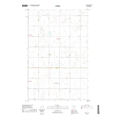
2020 Map of Mylo SE
USGS Topo · Published 2020About this map
Rolette County and Pierce County converge in this agricultural landscape of the North Dakota prairie. The terrain is characterized by the complex wetland systems and glacial depressions typical of the region, organized by a rigid grid of rural roads like 49th Ave NE and 81st St NE. Local heritage is anchored by two significant landmarks: the Mylo Community Cemetery in the north and the Pleasant Valley Cemetery further south. These sites serve as primary identifiers for the dispersed farming community, marking the locations of early congregational life and family lineage in a region where the vast prairie has been systematically divided into sections and townships.
Find a feature on this map
22 named features on this map. Tap any name to fly to it.
Don’t see what you’re looking for? This feature index may not catch every label — zoom into the map to look around manually.
Map Details
Editions of this 2020 Mylo SE Map
This is the sole edition of this map. No revisions or reprints were ever made.
Other maps of this area

1953 · Devils Lake
USGS Topo · 1:250,000

1956 · Devils Lake
USGS Topo · 1:250,000

1971 · Wolford
USGS Topo · 1:24,000

1971 · Bisbee South
USGS Topo · 1:24,000

1971 · Island Lake
USGS Topo · 1:24,000

1971 · Mylo
USGS Topo · 1:24,000

1971 · Hurricane Lake West
USGS Topo · 1:24,000

1971 · Bisbee North
USGS Topo · 1:24,000

1971 · Mylo NW
USGS Topo · 1:24,000

1971 · Mylo SE
USGS Topo · 1:24,000