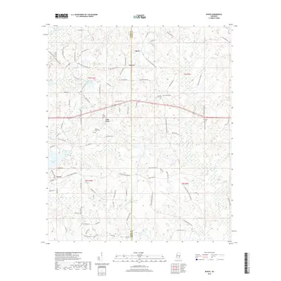
2018 Map of Myrick
USGS Topo · Published 2018About this map
The settlement of Myrick sits at the southwestern edge of this landscape, where the headwaters of Little Mill Cr and Bull Br carve into the Jones County countryside. Much of the area's local history is anchored by its community burial grounds, including the Myrick Cem, Mill Creek Cem, and the family-named Dennis Blackledge Cem and Sellers Cem. Smaller clusters like Lightsey, Pineview, and Mill Creek are connected by a network of rural routes, including Huey Shed Rd and Poole Creek Rd. Water defines the northern reaches, where Little Bogue Homo and Rolling Hills Ranch Lake provide drainage near the Jones County and Wayne County line. The terrain is marked by numerous small branches such as Brake Br and Jenkins Br, suggesting a well-watered timber or agricultural district.
Find a feature on this map
102 named features on this map. Tap any name to fly to it.
Don’t see what you’re looking for? This feature index may not catch every label — zoom into the map to look around manually.
Map Details
Editions of this 2018 Myrick Map
This is the sole edition of this map. No revisions or reprints were ever made.
Other maps of this area

1953 · Hattiesburg
USGS Topo · 1:250,000

1958 · Hattiesburg
USGS Topo · 1:250,000

1964 · Heidelberg SW
USGS Topo · 1:24,000

1964 · Sandersville
USGS Topo · 1:24,000

1964 · Eucutta
USGS Topo · 1:24,000

1964 · Laurel East
USGS Topo · 1:24,000

1964 · Myrick
USGS Topo · 1:24,000

1964 · Strengthford
USGS Topo · 1:24,000

1964 · Whistler
USGS Topo · 1:24,000

1964 · Lanham
USGS Topo · 1:24,000