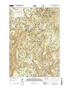
2014 Map of Myrtle Park Meadows
USGS Topo · Published 2014About this map
Malhuer National Forest encompasses the high-country terrain where Myrtle Creek and numerous spring-fed tributaries define the drainage patterns of the northern Great Basin. This high desert landscape is characterized by its seasonal meadows and flats, including Myrtle Park Meadows and Craddock Meadows, which have historically served as vital watering grounds in this arid region. The map details an extensive network of forest roads such as the Burnt Mountain Road and National Forest Development Road 384, which provide access to interior landmarks like Gold Hill and Burnt Mountain. A dense concentration of named springs, such as Old Road Camp Spring, Rawhide Spring, and Chesmore Spring, indicates the critical role of water management and livestock grazing history within these public lands. The boundary between Grant and Harney counties bisects the northern half of the quadrangle, marking a high-elevation divide among the numerous canyons and flats.
Find a feature on this map
65 named features on this map. Tap any name to fly to it.
Don’t see what you’re looking for? This feature index may not catch every label — zoom into the map to look around manually.
Map Details
Editions of this 2014 Myrtle Park Meadows Map
This is the sole edition of this map. No revisions or reprints were ever made.
Other maps of this area

1955 · Burns
USGS Topo · 1:250,000

1955 · Canyon City
USGS Topo · 1:250,000

1958 · Burns
USGS Topo · 1:250,000

1959 · Burns
USGS Topo · 1:250,000

1959 · Canyon City
USGS Topo · 1:250,000

1959 · West Myrtle Butte
USGS Topo · 1:62,500

1961 · Calamity Butte
USGS Topo · 1:62,500

1961 · Logdell
USGS Topo · 1:62,500

1961 · Seneca
USGS Topo · 1:62,500

1978 · John Day
USGS Topo · 1:100,000