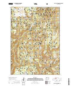
2020 Map of Myrtle Park Meadows
USGS Topo · Published 2020About this map
Myrtle Park Meadows lies along the border of Grant and Harney counties, situated within the high-elevation evergreen stands of the Malheur National Forest. This 2020 survey documents a landscape defined by its vital water sources and open grazing lands, including Craddock Meadows and Burnt Mountain Meadows. The geography is a complex network of seasonal drainages and springs, such as Chesmore Spring and Old Road Camp Spring, which historically supported livestock and logging operations. The Silvies River and Myrtle Cr carve through the terrain, flanked by prominent rises like Gold Hill and Burnt Mtn. Researchers will find a detailed view of the forest's primitive road system and the names of remote flats and canyons, including Crane Flats and Badger Canyon, which speak to the area's early 20th-century range and wildlife history.
Find a feature on this map
53 named features on this map. Tap any name to fly to it.
Don’t see what you’re looking for? This feature index may not catch every label — zoom into the map to look around manually.
Map Details
Editions of this 2020 Myrtle Park Meadows Map
This is the sole edition of this map. No revisions or reprints were ever made.
Other maps of this area

1955 · Burns
USGS Topo · 1:250,000

1955 · Canyon City
USGS Topo · 1:250,000

1958 · Burns
USGS Topo · 1:250,000

1959 · Burns
USGS Topo · 1:250,000

1959 · Canyon City
USGS Topo · 1:250,000

1959 · West Myrtle Butte
USGS Topo · 1:62,500

1961 · Calamity Butte
USGS Topo · 1:62,500

1961 · Logdell
USGS Topo · 1:62,500

1961 · Seneca
USGS Topo · 1:62,500

1978 · John Day
USGS Topo · 1:100,000