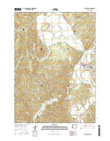
2017 Map of Myrtle Point
USGS Topo · Published 2017About this map
The Coquille River and its various forks anchor the landscape of this Coos County region, where the North Fork Coquille River and South Fork Coquille River meet near the town of Myrtle Point. The 2017 terrain is characterized by a complex network of waterways and valleys, including Pleasant Valley and Four Bit Gulch. Industrial legacies are visible through the Myrtle Point Log Pond, reflecting the timber-driven economy of the Pacific Northwest.
Find a feature on this map
96 named features on this map. Tap any name to fly to it.
Don’t see what you’re looking for? This feature index may not catch every label — zoom into the map to look around manually.
Map Details
Editions of this 2017 Myrtle Point Map
This is the sole edition of this map. No revisions or reprints were ever made.
Other maps of this area

1896 · Coos Bay
USGS Topo · 1:125,000

1898 · Coos Bay
USGS Topo · 1:125,000

1899 · Port Orford
USGS Topo · 1:125,000

1900 · Coos Bay
USGS Topo · 1:125,000

1903 · Port Orford
USGS Topo · 1:125,000

1942 · Coquille
USGS Topo · 1:62,500

1943 · Bandon
USGS Topo · 1:62,500

1944 · Bandon
USGS Topo · 1:62,500

1945 · Coquille
USGS Topo · 1:62,500

1954 · Coos Bay
USGS Topo · 1:250,000