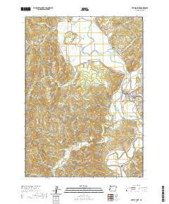
2020 Map of Myrtle Point
USGS Topo · Published 2020About this map
The Coquille River valley serves as the central artery for this Coos County landscape, where the North Fork Coquille River and South Fork Coquille River converge near Myrtle Point. This area reflects a long history of timber and river-based industry, anchored by the Myrtle Point Log Pond and surrounded by smaller settlements like Arago, Norway, and Broadbent. The terrain transitions from the wide floodplains of Pleasant Valley to the steeper ridges of Cribbins Hill and Robbins Butte. Genealogists will find a high concentration of burial sites throughout the forks, including the Norway Cem, Fishtrap Cem, and the remote Catching Creek Cem. The map detail traces numerous winding rural routes like Myrtle Point-Lampa Rd and Fishtrap-Collier Rd that connected these timber and dairy communities.
Find a feature on this map
86 named features on this map. Tap any name to fly to it.
Don’t see what you’re looking for? This feature index may not catch every label — zoom into the map to look around manually.
Map Details
Editions of this 2020 Myrtle Point Map
This is the sole edition of this map. No revisions or reprints were ever made.
Other maps of this area

1896 · Coos Bay
USGS Topo · 1:125,000

1898 · Coos Bay
USGS Topo · 1:125,000

1899 · Port Orford
USGS Topo · 1:125,000

1900 · Coos Bay
USGS Topo · 1:125,000

1903 · Port Orford
USGS Topo · 1:125,000

1942 · Coquille
USGS Topo · 1:62,500

1943 · Bandon
USGS Topo · 1:62,500

1944 · Bandon
USGS Topo · 1:62,500

1945 · Coquille
USGS Topo · 1:62,500

1954 · Coos Bay
USGS Topo · 1:250,000