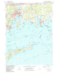
1984 Map of Mystic
USGS Topo · Published 1984About this map
Mystic Seaport anchors this maritime landscape where the Mystic River meets Fishers Island Sound. The 1984 survey highlights the dense coastal development and cultural institutions of the era, from the Marine Life Aquarium to the historic Lighthouse (Abandoned) at Stonington Point. Beyond the urban centers of Mystic and Stonington, the map details a complex archipelago including Mason Island, Andrews Island, and the northern reaches of Fishers Island.
Find a feature on this map
80 named features on this map. Tap any name to fly to it.
Don’t see what you’re looking for? This feature index may not catch every label — zoom into the map to look around manually.
Map Details
Editions of this 1984 Mystic Map
2 editions found
Other maps of this area

1889 · Stonington
USGS Topo · 1:62,500

1892 · New London
USGS Topo · 1:62,500

1893 · Stonington
USGS Topo · 1:62,500

1893 · New London
USGS Topo · 1:62,500

1903 · Gardiners Island
USGS Topo · 1:62,500

1904 · Gardiners Island
USGS Topo · 1:62,500

1904 · Montauk
USGS Topo · 1:62,500

1921 · Gardiners Island
USGS Topo · 1:62,500

1921 · New London
USGS Topo · 1:62,500

1921 · Stonington
USGS Topo · 1:62,500