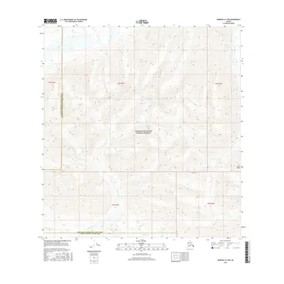
2016 Map of Nabesna A-2 NW
USGS Topo · Published 2016About this map
The Alaska Range provides the high-altitude backdrop for this portion of the Wrangell-Saint Elias National Preserve, where the landscape is defined by a dense network of glacial and snow-fed drainage systems. High-relief topography dominates the quadrangle, with elevation contours illustrating the steep descent from interior peaks toward the Chisana River in the northwest and Sheep Creek to the east. The map records the complex hydrology of the region, tracing the paths of numerous named tributaries including Sweetwater Cr, Sargent Cr, and Chavolda Creek. The boundary between the Valdez-Cordova and Southeast Fairbanks Census Areas bisects the terrain, highlighting the remote administrative divisions within this largely roadless wilderness. This survey is particularly useful for understanding the natural water courses before modern shifts in glacial melt affected local stream flow.
Find a feature on this map
20 named features on this map. Tap any name to fly to it.
Don’t see what you’re looking for? This feature index may not catch every label — zoom into the map to look around manually.
Map Details
Editions of this 2016 Nabesna A-2 NW Map
This is the sole edition of this map. No revisions or reprints were ever made.
Other maps of this area

1950 · Nabesna
USGS Topo · 1:250,000

1951 · Nabesna
USGS Topo · 1:250,000

1960 · Nabesna A-3
USGS Topo · 1:63,360

1960 · Nabesna A-2
USGS Topo · 1:63,360

1960 · Nabesna B-2
USGS Topo · 1:63,360

1960 · Nabesna
USGS Topo · 1:250,000

1960 · Nabesna B-3
USGS Topo · 1:63,360
2016 · Nabesna A-2 NE
USGS Topo · 1:25,000
2016 · Nabesna B-2 SE
USGS Topo · 1:25,000
2016 · Nabesna B-2 SW
USGS Topo · 1:25,000