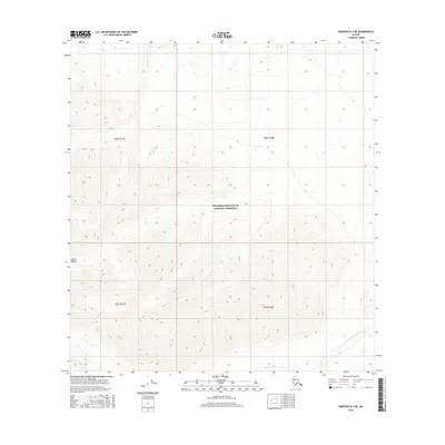
2016 Map of Nabesna B-3 NE
USGS Topo · Published 2016About this map
Wrangell-Saint Elias National Preserve encompasses most of this landscape, where the northern reaches of the Alaska Range dominate the topography. The terrain is defined by dramatic elevation changes, with ridges sloping toward the drainage basins of Stuver Creek in the southeast and Lick Cr in the north. This 2016 survey illustrates a purely wilderness environment, devoid of roads or permanent settlements, preserving a corner of the Alaskan interior as it appeared in the early 21st century. The map provides a detailed view of the natural watercourses, including Antler Cr, as they navigate the high-altitude contours of the preserve.
Find a feature on this map
9 named features on this map. Tap any name to fly to it.
Don’t see what you’re looking for? This feature index may not catch every label — zoom into the map to look around manually.
Map Details
Editions of this 2016 Nabesna B-3 NE Map
This is the sole edition of this map. No revisions or reprints were ever made.
Other maps of this area

1950 · Nabesna
USGS Topo · 1:250,000

1951 · Nabesna
USGS Topo · 1:250,000

1954 · Nabesna C-3
USGS Topo · 1:63,360

1955 · Nabesna C-2
USGS Topo · 1:63,360

1955 · Nabesna C-3
USGS Topo · 1:63,360

1960 · Nabesna B-2
USGS Topo · 1:63,360

1960 · Nabesna
USGS Topo · 1:250,000

1960 · Nabesna B-3
USGS Topo · 1:63,360
2016 · Nabesna C-2 SW
USGS Topo · 1:25,000
2016 · Nabesna B-2 SW
USGS Topo · 1:25,000