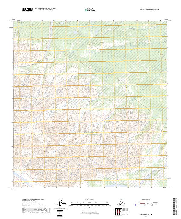
2023 Map of Nabesna B-3 NE
USGS Topo · Published 2023About this map
The Wrangell-Saint Elias National Preserve encompasses much of this interior Alaskan landscape, where the high peaks of the Nutzotin Mountains meet the eastern reaches of the Alaska Range. This high-altitude terrain is defined by a series of north-flowing drainages that carve through the wilderness, including the headwaters of Antler Creek and the meandering path of Stuver Creek. A small portion of Lick Creek is also visible in the northern township. This survey provides an essential look at the physical geography of the Copper River Census Area before further glacial retreat or environmental changes alter the drainage patterns. The lack of roads or established settlements emphasizes the remote character of this protected preserve, serving as a baseline for environmental historians and those studying the preservation of subarctic mountain ecosystems.
Find a feature on this map
10 named features on this map. Tap any name to fly to it.
Don’t see what you’re looking for? This feature index may not catch every label — zoom into the map to look around manually.
Map Details
Editions of this 2023 Nabesna B-3 NE Map
This is the sole edition of this map. No revisions or reprints were ever made.
Other maps of this area

1950 · Nabesna
USGS Topo · 1:250,000

1951 · Nabesna
USGS Topo · 1:250,000

1954 · Nabesna C-3
USGS Topo · 1:63,360

1955 · Nabesna C-2
USGS Topo · 1:63,360

1955 · Nabesna C-3
USGS Topo · 1:63,360

1960 · Nabesna B-2
USGS Topo · 1:63,360

1960 · Nabesna
USGS Topo · 1:250,000

1960 · Nabesna B-3
USGS Topo · 1:63,360
2016 · Nabesna C-2 SW
USGS Topo · 1:25,000
2016 · Nabesna B-2 SW
USGS Topo · 1:25,000