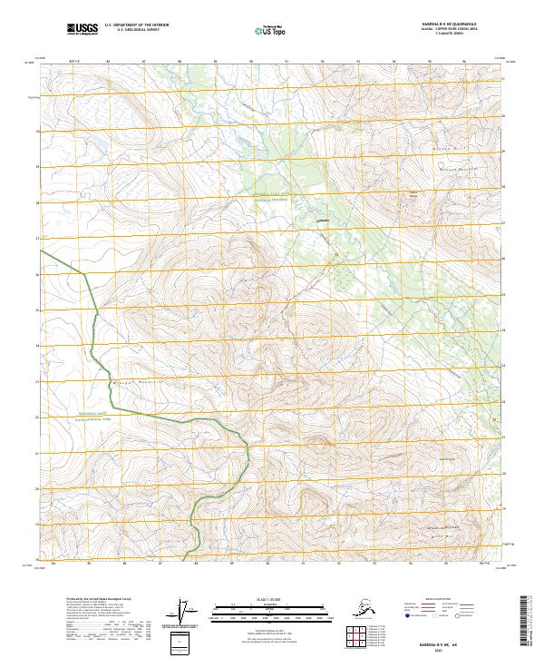
2023 Map of Nabesna B-5 NE
USGS Topo · Published 2023About this map
Nabesna marks a critical point of human presence in this high-altitude landscape, situated where Nabesna Road enters the Wrangell-Saint Elias National Preserve. The geography is defined by the convergence of major ranges, with the southern reaches of the Alaska Range meeting the Mentasta Mountains and the Boyden Hills. This 2023 survey details a transition from the lower wetlands near Jack Creek and Chalk Creek to the high peaks of the Wrangell Mountains. Significant geological and recreational features include the Skookum Volcano Trl, which provides access toward the mineral-rich drainages of Garnet Gulch and Cliff Gulch-Porphyry Gulch near White Mtn. The map preserves the modern state of the Wrangell-St. Elias Wilderness, illustrating how access routes like the Nabesna Road navigate the complex drainage systems of Boyden Creek and Skookum Creek.
Find a feature on this map
22 named features on this map. Tap any name to fly to it.
Don’t see what you’re looking for? This feature index may not catch every label — zoom into the map to look around manually.
Map Details
Editions of this 2023 Nabesna B-5 NE Map
This is the sole edition of this map. No revisions or reprints were ever made.
Other maps of this area

1950 · Nabesna
USGS Topo · 1:250,000

1951 · Nabesna
USGS Topo · 1:250,000

1957 · Nabesna C-5
USGS Topo · 1:63,360

1960 · Nabesna B-4
USGS Topo · 1:63,360

1960 · Nabesna B-5
USGS Topo · 1:63,360

1960 · Nabesna
USGS Topo · 1:250,000

1960 · Nabesna C-4
USGS Topo · 1:63,360
1960 · Nabesna C-5
USGS Topo · 1:63,360
2016 · Nabesna B-4 NW
USGS Topo · 1:25,000
2016 · Nabesna B-5 SE
USGS Topo · 1:25,000