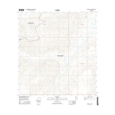
2016 Map of Nabesna B-5 SE
USGS Topo · Published 2016About this map
Wrangell-Saint Elias National Park and the adjacent Wrangell-Saint Elias National Preserve dominate this corner of the Wrangell Mountains, where the landscape is defined by massive elevational changes and glacial drainages. The map provides a detailed view of the high-altitude terrain surrounding Gold Hill and the deep incision of Jacksina Creek as it flows northward. This 2016 survey captures a wilderness interface where water systems like Canyon Cr, Wait Cr, and Cabin Cr carve through the steep topography. The presence of Swede Gulch suggests a history of localized exploration or prospecting within the broader context of the Alaskan interior. The grid-based surveying of T7N R12E and T7N R13E provides a precise structural framework for understanding these remote drainage patterns and mountain features in a modern context.
Find a feature on this map
13 named features on this map. Tap any name to fly to it.
Don’t see what you’re looking for? This feature index may not catch every label — zoom into the map to look around manually.
Map Details
Editions of this 2016 Nabesna B-5 SE Map
This is the sole edition of this map. No revisions or reprints were ever made.
Other maps of this area

1950 · Nabesna
USGS Topo · 1:250,000

1951 · Nabesna
USGS Topo · 1:250,000

1959 · Nabesna A-4
USGS Topo · 1:63,360

1959 · Nabesna A-5
USGS Topo · 1:63,360

1960 · Nabesna B-4
USGS Topo · 1:63,360

1960 · Nabesna B-5
USGS Topo · 1:63,360

1960 · Nabesna
USGS Topo · 1:250,000
2016 · Nabesna A-4 NW
USGS Topo · 1:25,000
2016 · Nabesna B-4 NW
USGS Topo · 1:25,000
2016 · Nabesna A-5 NW
USGS Topo · 1:25,000