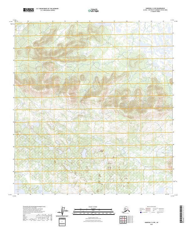
2023 Map of Nabesna C-2 NW
USGS Topo · Published 2023About this map
Tetlin National Wildlife Refuge encompasses nearly the entire landscape in this part of the Southeast Fairbanks Census Area. The terrain is defined by a distinct transition from the elevated Black Hills in the north to an extensive wetland complex in the south. This lower basin is characterized by a dense network of ponds and larger water bodies, including Tahamund Lake and Jatahmund Lake, which dominate the drainage pattern of the refuge. The mapping reveals a wilderness largely devoid of modern road infrastructure, preserving the natural hydrological state of the region. Localized elevations like Takomahto Lake and Jatamund Lake provide specific geographic points of reference within the broader protected interior of eastern Alaska.
Find a feature on this map
11 named features on this map. Tap any name to fly to it.
Don’t see what you’re looking for? This feature index may not catch every label — zoom into the map to look around manually.
Map Details
Editions of this 2023 Nabesna C-2 NW Map
This is the sole edition of this map. No revisions or reprints were ever made.
Other maps of this area

1950 · Nabesna
USGS Topo · 1:250,000

1951 · Nabesna
USGS Topo · 1:250,000

1954 · Nabesna D-2
USGS Topo · 1:63,360

1954 · Nabesna D-3
USGS Topo · 1:63,360

1954 · Nabesna C-3
USGS Topo · 1:63,360

1955 · Nabesna C-2
USGS Topo · 1:63,360

1955 · Nabesna D-3
USGS Topo · 1:63,360

1955 · Nabesna C-3
USGS Topo · 1:63,360

1955 · Nabesna D-2
USGS Topo · 1:63,360

1960 · Nabesna
USGS Topo · 1:250,000