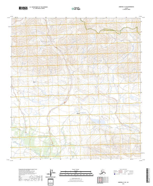
2023 Map of Nabesna C-5 SE
USGS Topo · Published 2023About this map
The Mentasta Mountains dominate the northern landscape of this interior Alaskan territory, where the settlements of Slana and Nabesna are connected by the lifeline of the Nabesna Road. This corridor serves as a vital transit point between the Wrangell-Saint Elias National Park and the adjacent Wrangell-Saint Elias National Preserve. The map documents a network of backcountry routes, including the Lost Creek Trl and the Soda Lake Reroute Trl, which navigate the complex drainage systems of Chalk Creek and Lost Creek. To the south, the Boyden Hills rise above Big Grayling Lake, marking a transition in the terrain. The boundary between the Copper River and Southeast Fairbanks Census Areas is clearly delineated across the northern peaks, illustrating the administrative divisions of this high-elevation wilderness.
Find a feature on this map
26 named features on this map. Tap any name to fly to it.
Don’t see what you’re looking for? This feature index may not catch every label — zoom into the map to look around manually.
Map Details
Editions of this 2023 Nabesna C-5 SE Map
This is the sole edition of this map. No revisions or reprints were ever made.
Other maps of this area

1950 · Nabesna
USGS Topo · 1:250,000

1951 · Nabesna
USGS Topo · 1:250,000

1957 · Nabesna C-5
USGS Topo · 1:63,360

1960 · Nabesna B-4
USGS Topo · 1:63,360

1960 · Nabesna B-5
USGS Topo · 1:63,360

1960 · Nabesna
USGS Topo · 1:250,000

1960 · Nabesna C-4
USGS Topo · 1:63,360
1960 · Nabesna C-5
USGS Topo · 1:63,360
2016 · Nabesna C-4 NW
USGS Topo · 1:25,000
2016 · Nabesna B-4 NW
USGS Topo · 1:25,000