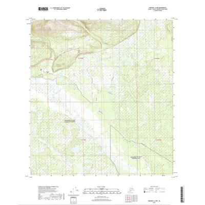
2019 Map of Nabesna C-6 NW
USGS Topo · Published 2019About this map
The settlement of Slana sits at a significant interior junction where the Tok-Cutoff Highway meets Nabesna Road, serving as a gateway to the expansive wilderness of the Wrangell-St. Elias National Preserve. This landscape is defined by the confluence of the Slana River and the mighty Copper River, which dominate the drainage patterns of the valley floor. To the north, the terrain rises toward Ahtell Creek, while the southern portion of the map transitions into the Wrangell-St. Elias National Park. Transportation infrastructure is concentrated near the settlement, including the Duffys Tavern Airport and several local routes such as 4 Mile Road and Cash Boulevard. The presence of numerous smaller tributaries like Suslota Creek and Natar Creek illustrates the complex hydrological network typical of this Alaskan subarctic region.
Find a feature on this map
24 named features on this map. Tap any name to fly to it.
Don’t see what you’re looking for? This feature index may not catch every label — zoom into the map to look around manually.
Map Details
Editions of this 2019 Nabesna C-6 NW Map
This is the sole edition of this map. No revisions or reprints were ever made.
Other maps of this area

1948 · Nabesna C-6
USGS Topo · 1:63,360

1949 · Nabesna D-6
USGS Topo · 1:63,360

1949 · Gulkana C-1
USGS Topo · 1:63,360

1950 · Nabesna
USGS Topo · 1:250,000

1951 · Gulkana
USGS Topo · 1:250,000

1951 · Nabesna
USGS Topo · 1:250,000

1952 · Nabesna C-6
USGS Topo · 1:63,360

1952 · Nabesna D-6
USGS Topo · 1:63,360

1952 · Gulkana C-1
USGS Topo · 1:63,360
1954 · Gulkana D-1
USGS Topo · 1:63,360