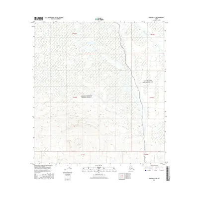
2016 Map of Nabesna C-6 SW
USGS Topo · Published 2016About this map
Copper River flows through the eastern portion of this terrain, marking a significant hydrological boundary within the Alaskan interior. The landscape is primarily defined by its protected status, split between the Wrangell-Saint Elias National Preserve and the Wrangell-Saint Elias National Park. This division reflects complex land management at the turn of the 21st century, where subsistence hunting and other traditional uses are often permitted in the preserve while more strictly limited within the park proper. The drainage system is further detailed by Drop Creek, which meanders across the central flats before joining the larger river system, and smaller water bodies such as Boomerang Lake. Remote landmarks like Tanada and Caribou Cr provide specific points of reference for those navigating this unorganized borough territory.
Find a feature on this map
13 named features on this map. Tap any name to fly to it.
Don’t see what you’re looking for? This feature index may not catch every label — zoom into the map to look around manually.
Map Details
Editions of this 2016 Nabesna C-6 SW Map
This is the sole edition of this map. No revisions or reprints were ever made.
Other maps of this area

1948 · Nabesna C-6
USGS Topo · 1:63,360

1949 · Gulkana C-1
USGS Topo · 1:63,360

1950 · Nabesna
USGS Topo · 1:250,000

1951 · Gulkana
USGS Topo · 1:250,000

1951 · Nabesna
USGS Topo · 1:250,000

1952 · Nabesna C-6
USGS Topo · 1:63,360

1952 · Gulkana C-1
USGS Topo · 1:63,360

1959 · Gulkana B-1
USGS Topo · 1:63,360

1959 · Gulkana
USGS Topo · 1:250,000

1960 · Nabesna
USGS Topo · 1:250,000