
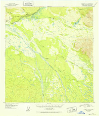
1952 Map of Nabesna C-6
USGS Topo · Published 1952About this map
Slana serves as the primary hub of this Alaskan interior landscape, situated where the Glenn Highway makes its way through the region. In the early 1950s, the area reflects the state of post-war infrastructure development, highlighted by the presence of the Alaska Road Commission Camp and the construction occurring along the route. The Copper River and its intricate network of tributaries, including the braided channels of Drop Creek, dominate the valley floor, while the Mentasta Mountains rise sharply to the northeast.
Find a feature on this map
18 named features on this map. Tap any name to fly to it.
Don’t see what you’re looking for? This feature index may not catch every label — zoom into the map to look around manually.
Map Details
Editions of this 1952 Nabesna C-6 Map
2 editions found
Other maps of this area

1948 · Nabesna C-6
USGS Topo · 1:63,360

1948 · Nabesna D-5
USGS Topo · 1:63,360

1949 · Nabesna D-6
USGS Topo · 1:63,360

1949 · Gulkana C-1
USGS Topo · 1:63,360

1950 · Nabesna
USGS Topo · 1:250,000

1950 · Nabesna D-5
USGS Topo · 1:63,360

1951 · Gulkana
USGS Topo · 1:250,000

1951 · Nabesna
USGS Topo · 1:250,000

1952 · Nabesna D-5
USGS Topo · 1:63,360

1952 · Nabesna D-6
USGS Topo · 1:63,360