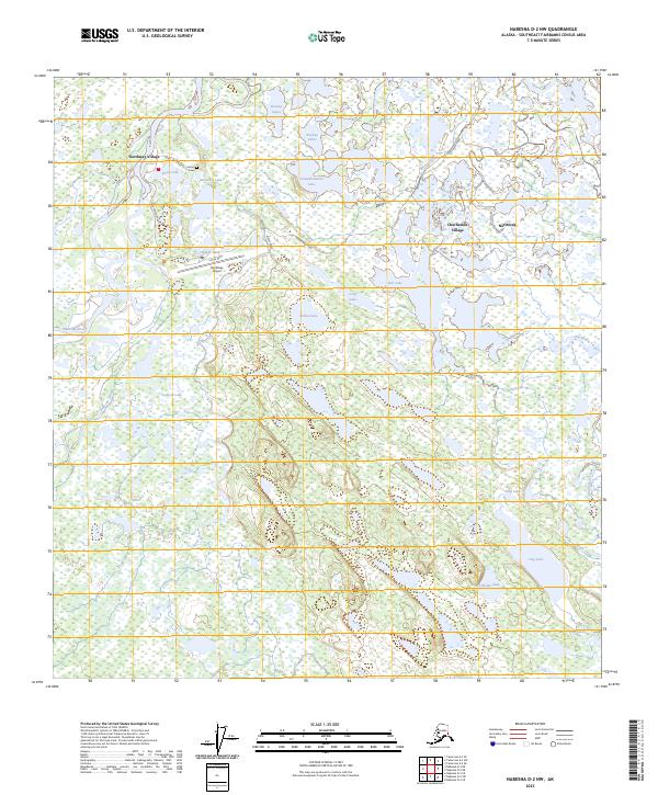
2023 Map of Nabesna D-2 NW
USGS Topo · Published 2023About this map
Northway Village and Charlieskin Village serve as the primary human settlements in this wetland-dense region of the upper Tanana Valley. The landscape is defined by the winding paths of the Nabesna River and Chisana River, which create a complex network of sloughs, creeks, and muskeg lakes. Significant local landmarks include the Northway Airport and the Indian Cem located near Skate Lake. Much of the southern portion of the map is protected within the Tetlin National Wildlife Refuge, where features like Dog Lake and Hillside Lake indicate the undisturbed character of the wilderness. The infrastructure is concentrated along Northway Road, connecting the villages to the airfield, reflecting the vital role of aviation in this interior Alaskan community.
Find a feature on this map
31 named features on this map. Tap any name to fly to it.
Don’t see what you’re looking for? This feature index may not catch every label — zoom into the map to look around manually.
Map Details
Editions of this 2023 Nabesna D-2 NW Map
This is the sole edition of this map. No revisions or reprints were ever made.
Other maps of this area

1948 · Tanacross A-3
USGS Topo · 1:63,360

1949 · Tanacross
USGS Topo · 1:250,000

1950 · Tanacross
USGS Topo · 1:250,000

1950 · Nabesna
USGS Topo · 1:250,000

1951 · Nabesna
USGS Topo · 1:250,000

1952 · Tanacross A-3
USGS Topo · 1:63,360

1954 · Tanacross A-2
USGS Topo · 1:63,360

1954 · Nabesna D-2
USGS Topo · 1:63,360

1954 · Nabesna D-3
USGS Topo · 1:63,360

1955 · Nabesna D-3
USGS Topo · 1:63,360