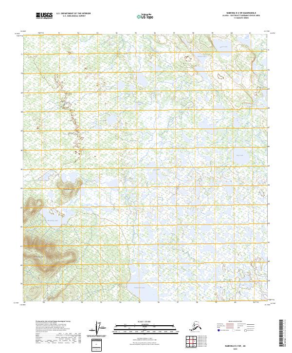
2023 Map of Nabesna D-2 SW
USGS Topo · Published 2023About this map
Tetlin National Wildlife Refuge encompasses this vast wetland complex in the Southeast Fairbanks Census Area, where a dense network of lakes and braided waterways defines the interior Alaskan landscape. The terrain is characterized by low-lying basins filled with numerous named water bodies, including the centrally located Clearwater Lake, Deep Lake to the east, and the interconnected Fish Lakes. These waters are fed and drained by systems like Chidaglekne Creek, which meanders through the marshy lowlands. Rising above the saturated flats are distinct topographic elevations such as Klunathkada Hill and Schonthda Hill, which provide relief within the broader Bird Hills region. This survey highlights the complex hydrology of the Tanana River valley, illustrating how subtle changes in elevation create a mosaic of aquatic and terrestrial habitats essential to the subarctic ecosystem.
Find a feature on this map
19 named features on this map. Tap any name to fly to it.
Don’t see what you’re looking for? This feature index may not catch every label — zoom into the map to look around manually.
Map Details
Editions of this 2023 Nabesna D-2 SW Map
This is the sole edition of this map. No revisions or reprints were ever made.
Other maps of this area

1950 · Nabesna
USGS Topo · 1:250,000

1951 · Nabesna
USGS Topo · 1:250,000

1954 · Nabesna D-2
USGS Topo · 1:63,360

1954 · Nabesna D-3
USGS Topo · 1:63,360

1954 · Nabesna C-3
USGS Topo · 1:63,360

1955 · Nabesna C-2
USGS Topo · 1:63,360

1955 · Nabesna D-3
USGS Topo · 1:63,360

1955 · Nabesna C-3
USGS Topo · 1:63,360

1955 · Nabesna D-2
USGS Topo · 1:63,360

1960 · Nabesna
USGS Topo · 1:250,000