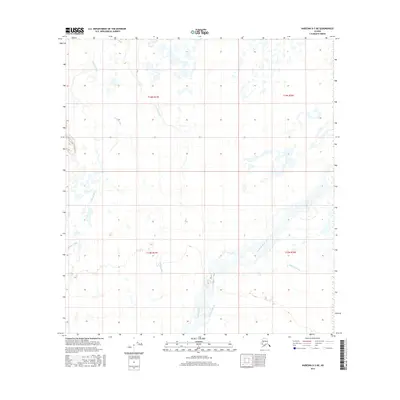
2016 Map of Nabesna D-3 NE
USGS Topo · Published 2016About this map
Nabesna River and its wide, braided valley dominate the southeastern reaches of this interior Alaskan landscape. This 2016 survey illustrates a complex riparian environment where the primary river channel is flanked by the Nabesna Slough, creating a network of shifting waterways and wetlands. Further west, the Kalukna River meanders through the terrain, while a portion of the Tetlin River is visible at the western margin. The lack of roads or permanent settlements emphasizes the wilderness character of the region, defined primarily by its hydrology and the public land survey grid, including t14n r17e and t13n r18e. Geologists and naturalists can use this sheet to study the drainage patterns and floodplain dynamics of these significant glacial-fed systems.
Find a feature on this map
8 named features on this map. Tap any name to fly to it.
Don’t see what you’re looking for? This feature index may not catch every label — zoom into the map to look around manually.
Map Details
Editions of this 2016 Nabesna D-3 NE Map
This is the sole edition of this map. No revisions or reprints were ever made.
Other maps of this area

1948 · Tanacross A-3
USGS Topo · 1:63,360

1949 · Tanacross
USGS Topo · 1:250,000

1950 · Tanacross
USGS Topo · 1:250,000

1950 · Nabesna
USGS Topo · 1:250,000

1951 · Nabesna
USGS Topo · 1:250,000

1952 · Tanacross A-3
USGS Topo · 1:63,360

1954 · Tanacross A-2
USGS Topo · 1:63,360

1954 · Nabesna D-2
USGS Topo · 1:63,360

1954 · Nabesna D-3
USGS Topo · 1:63,360

1955 · Nabesna D-3
USGS Topo · 1:63,360