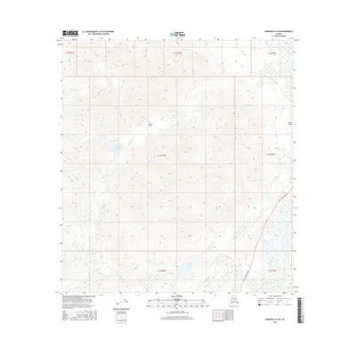
2016 Map of Nabesna D-6 SW
USGS Topo · Published 2016About this map
Indian Pass and the surrounding high-altitude terrain of the Alaska Range define this portion of the interior, where water systems dictate the movement across the landscape. The northern reaches are characterized by the headwaters of Porcupine Cr and the secluded Indian Pass Lake, while the southern half of the quadrangle centers on the larger Carlson Lake. This 2016 survey documents a wilderness primarily accessible via the Tok Cutoff Highway, which skirts the southeastern corner of the map. The road provides the primary link to the outside world, following the course of the Slana River and Carlson Cr. The topography here is marked by significant elevation changes, illustrating the drainage patterns that feed into these sub-arctic river systems far from major urban centers.
Find a feature on this map
16 named features on this map. Tap any name to fly to it.
Don’t see what you’re looking for? This feature index may not catch every label — zoom into the map to look around manually.
Map Details
Editions of this 2016 Nabesna D-6 SW Map
This is the sole edition of this map. No revisions or reprints were ever made.
Other maps of this area

1948 · Nabesna C-6
USGS Topo · 1:63,360

1949 · Nabesna D-6
USGS Topo · 1:63,360

1949 · Gulkana C-1
USGS Topo · 1:63,360

1950 · Nabesna
USGS Topo · 1:250,000

1951 · Gulkana
USGS Topo · 1:250,000

1951 · Nabesna
USGS Topo · 1:250,000

1952 · Nabesna C-6
USGS Topo · 1:63,360

1952 · Nabesna D-6
USGS Topo · 1:63,360

1952 · Gulkana C-1
USGS Topo · 1:63,360
1954 · Gulkana D-1
USGS Topo · 1:63,360